 Irish Spatial Data Exchange
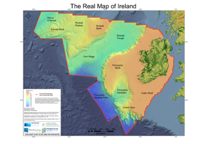
South Rockall Trough Sub-surface Mooring Deployment from April 2020 - June 2021
Deployment of a sub-surface mooring at South Rockall (52° 59.956' N, -16° 28.84' W) from the RV Celtic Explorer survey CE20001 on 26/04/2020. Recovered on 02/06/2021 by the RV Celtic Explorer survey CE21014. Upon recovery, it was apparent that the top float with a Teledyne ADCP and a CTD were missing and pressumed lost. On interrogation of the CTD data from the remaining part of the mooring, it became clear that the
mooring was split on March 16th 2020.
However, in Decmeber 2021, colleagues at the Scottish Association for Marine Science
(SAMS) notified the Marine Institute that they had recovered the float along with the ADCP and attached CTD after it had washed up on a beach on the Isle of Tiree off the west
coast of Scotland on December 4th 2021.
The sensors were sent back to the Marine Institute for a successful recovery. The purpose of this activity is to collect data to help understand the variability in the water column not visible at the surface and provide context to CTD profile data collected in the South Rockall Trough. These data are vital in understanding the likely impact of future ocean climate scenarios on key marine sectors as well as understanding possible impacts on ecosystem in the North East Atlantic Ocean.
Simple
- Date (Publication)
- 2021-11-03
- Date (Revision)
- 2025-02-21
- Date (Creation)
- 2021-11-03
- Citation identifier
- ie.marine.data:dataset.4844
- Point of contact
-
Organisation name Individual name Electronic mail address Role Marine Institute
Originator
- Maintenance and update frequency
- As needed
- Use limitation
-
While every effort is made in preparing the dataset no responsibility is accepted by or on behalf of the Marine Institute for any errors, omissions or misleading information. The Marine Institute accepts no responsibility for loss or damage occasioned or claimed to have been occasioned, in part or in full, as a consequence of any person acting, or refraining from acting as a result of a matter contained in this datasets or as a consequence of using this dataset for any purpose whatsoever.
- Use limitation
-
A Creative Commons (CC) license is one of several public copyright licenses that enable the free distribution of an otherwise copyrighted work. A CC license is used when an author wants to give people the right to share, use, and build upon a work that they have created. Under Creative Commons CC BY 4.0 the following is granted: Rights Share — copy and redistribute the material in any medium or format; Adapt — remix, transform, and build upon the material for any purpose, even commercially. The licensor cannot revoke these freedoms as long as you follow the license terms. Requirements Attribution — You must give appropriate credit, provide a link to the license, and indicate if changes were made. You may do so in any reasonable manner, but not in any way that suggests the licensor endorses you or your use. No additional restrictions — You may not apply legal terms or technological measures that legally restrict others from doing anything the license permits.
- Access constraints
- CC%20BY%204.0
- Aggregate Datasetindentifier
- ie.marine.data:platform.40
- Association Type
- Cross reference
- Initiative Type
- Platform
- Aggregate Datasetindentifier
- ie.marine.data:dataset.4078
- Association Type
- Cross reference
- Initiative Type
- Collection
- Spatial representation type
- Text, table
- Language
- English
- Begin date
- 2020-04-26
- End date
- 2021-06-02
))
- Reference system identifier
- INSPIRE RS registry / http://www.opengis.net/def/crs/EPSG/0/3857
- OnLine resource
-
Protocol Linkage Name WWW:LINK-1.0-http--link
http://www.marine.ie
- Hierarchy level
- Dataset
Conformance result
- Title
-
Commission Regulation (EU) No 1089/2010 of 23 November 2010 implementing Directive 2007/2/EC of the European Parliament and of the Council as regards interoperability of spatial data sets and services
- Date (Publication)
- 2010-12-08
- Explanation
-
See the referenced specification
- Pass
- Yes
- Statement
-
Data supplied by Marine Institute.
Metadata
- File identifier
- ie.marine.data:dataset.4844 XML
- Metadata language
- English
- Hierarchy level
- Collection session
- Date stamp
- 2025-02-21T18:28:56.888801Z
- Metadata standard name
-
ISDI Metadata Profile
- Metadata standard version
-
1.2
- Metadata author
-
Organisation name Individual name Electronic mail address Role Marine Institute
Point of contact
)))
