 Irish Spatial Data Exchange
Sensitive Ecosystem Assessment and ROV Exploration of Reef - SeaRover
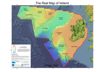
The SeaRover project (Sensitive Ecosystem Assessment and ROV Exploration of Reef) was a three year survey of Irelands deep-sea to establish the abundance and distribution of sensitive species and habitat types. Over 152 ROV dives were carried out, between 2017 and 2019, more than 300 hundred hours of video was captured of the seafloor. This extensive dataset includes: video files; transect map; date, time and position of biological and geomorphological observations per dive; species and habitat interpretation; and individual site synopses. The survey was funded by the European Maritime and Fisheries Fund (EMFF) and the National Parks and Wildlife Service (NPWS) as part of the EMFF’s Marine Biodiversity Scheme. The primary aim of the survey was to map the distribution and abundance of biogenic and geogenic reef habitat along Ireland’s continental margin using HD video.
Simple
- Date (Publication)
- 2021-10-11
- Date (Revision)
- 2023-06-01
- Date (Creation)
- 2021-10-11
- Citation identifier
- ie.marine.data:dataset.4837
- Point of contact
-
Organisation name Individual name Electronic mail address Role Marine Institute
Originator
- Maintenance and update frequency
- As needed
- Marine Strategy Framework Directive indicators 2010/477/EU
-
- Distributional range
- Distributional pattern
- Condition of the typical species and communities
- Relative abundance and/or biomass, as appropriate
- Composition and relative proportions of ecosystem components
- Type, abundance, biomass and areal extent of relevant biogenic substrate
- Extent of the seabed affected by human activities
- Presence of sensitive and/or tolerant species
- Spatial extent of habitats affected by the permanent alteration
- Changes in habitats, in particular the functions provided due to altered hydrographical conditions
- Use limitation
-
While every effort is made in preparing the dataset no responsibility is accepted by or on behalf of the Marine Institute for any errors, omissions or misleading information. The Marine Institute accepts no responsibility for loss or damage occasioned or claimed to have been occasioned, in part or in full, as a consequence of any person acting, or refraining from acting as a result of a matter contained in this datasets or as a consequence of using this dataset for any purpose whatsoever.
- Use limitation
-
A Creative Commons (CC) license is one of several public copyright licenses that enable the free distribution of an otherwise copyrighted work. A CC license is used when an author wants to give people the right to share, use, and build upon a work that they have created. Under Creative Commons CC BY 4.0 the following is granted: Rights Share — copy and redistribute the material in any medium or format; Adapt — remix, transform, and build upon the material for any purpose, even commercially. The licensor cannot revoke these freedoms as long as you follow the license terms. Requirements Attribution — You must give appropriate credit, provide a link to the license, and indicate if changes were made. You may do so in any reasonable manner, but not in any way that suggests the licensor endorses you or your use. No additional restrictions — You may not apply legal terms or technological measures that legally restrict others from doing anything the license permits.
- Access constraints
- CC%20BY%204.0
- Aggregate Datasetindentifier
- ie.marine.data:instrument.262
- Association Type
- Cross reference
- Initiative Type
- Sensor
- Aggregate Datasetindentifier
- ie.marine.data:instrument.263
- Association Type
- Cross reference
- Initiative Type
- Sensor
- Aggregate Datasetindentifier
- ie.marine.data:platform.33
- Association Type
- Cross reference
- Initiative Type
- Platform
- Aggregate Datasetindentifier
- ie.marine.data:dataset.4839
- Association Type
- Cross reference
- Initiative Type
- Collection
- Spatial representation type
- Vector
- Language
- English
- Begin date
- 2017-07-04
- End date
- 2019-08-20
))
- Reference system identifier
- INSPIRE RS registry / http://www.opengis.net/def/crs/EPSG/0/3857
- OnLine resource
-
Protocol Linkage Name WWW:LINK-1.0-http--link
http://www.marine.ie
- Hierarchy level
- Dataset
Conformance result
- Title
-
Commission Regulation (EU) No 1089/2010 of 23 November 2010 implementing Directive 2007/2/EC of the European Parliament and of the Council as regards interoperability of spatial data sets and services
- Date (Publication)
- 2010-12-08
- Explanation
-
See the referenced specification
- Pass
- Yes
- Statement
-
Data supplied by Marine Institute.
Metadata
- File identifier
- ie.marine.data:dataset.4837 XML
- Metadata language
- English
- Hierarchy level
- Collection session
- Date stamp
- 2025-02-21T18:28:54.181135Z
- Metadata standard name
-
ISDI Metadata Profile
- Metadata standard version
-
1.2
- Metadata author
-
Organisation name Individual name Electronic mail address Role Marine Institute
Point of contact
)))
