 Irish Spatial Data Exchange
CE21003 Marine Institute Ocean Climate Survey north East Atlantic Ocean 2021
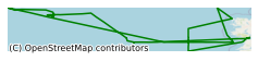
The 14 day Celtic Explorer CE21003 cruise took place in March 2021 to collect high quality oceanographic data to contribute to the Atlantic Ocean Observing System. Physical Oceanography: During the CE21003 cruise, full water column CTD (Conductivity, Temperature, Depth) casts were carried out. The Seabird 911 CTD profiles obtained measurements from ~ 2 m subsurface to ~10 m above the seabed with a CTD Rosette sampling system (24 X 10 L Niskin bottles) in the deep water South Rockall Trough ocean climate section and an extended part. Chemical Oceanography: Samples at targeted discrete depths were also collected to measure 1. Dissolved Oxygen , 2. Dissolved Inorganic Carbon/Total Alkalinity (DIC/TA) to constrain and describe the carbonate system, 3. Dissolved Inorganic nutrient samples: phosphate, total oxidised nitrogen, nitrite, silicate 4. Salinity sample analyses was carried out samples or analysed post-cruise?? Other cruise data collections include vessel underway data - temperature, salinity (calculated), DO and relative fluorescence in real-time using the CE CTD, DO, fluorometer underway system). The partial pressure of carbon dioxide (pCO2) data in real-time using the CE Global Oceanics underway system. Water column current velocity data with a hull mounted Ship Acoustic Doppler Current Profiler (SADCP). 2 ARGO floats were also deployed in the North East Atlantic Ocean subject to contribute to the EuroARGO programme [1 X ARGO floats to measure temperature, salinity and currents (lagrangian), and the other to measure temperature, salinity, DO and currents (lagrangian)]. Light and bio-optical variable data were also recorded using Trios RAMSES hyperspectral radiometers (in-air). The Ocean Climate cruise facilitates long-term monitoring of the deep-water environment to the west of Ireland. Oceanographic data collected contributes to the Atlantic Ocean Observing System and survey results are included in Ireland’s national report submitted each year to the International Council for the Exploration of the Sea (ICES) Working Group on Oceanic Hydrography (WGOH). Each year, the survey data is submitted to the ICES Data Centre through the ICES Working Group on Oceanic Hydrography (WGOH). This working group produces an annual ICES Report on Ocean Climate (IROC), which summarises oceanic variability from year to year in the ICES region. Multidisciplinary information collected on the survey can support future reporting Marine Strategy Framework Directive (2008/56/EC), OSPAR Coordinated Environmental Monitoring Programme, Irish Climate Change assessments (e.g., Nolan et al. 2009) and national research efforts (e.g., MI funded A4 project) that focuses on temporal dynamics of environmental variables in offshore deep territorial waters.
Simple
- Date (Publication)
- 2021-08-20
- Date (Revision)
- 2021-08-20
- Date (Creation)
- 2021-08-20
- Citation identifier
- ie.marine.data:dataset.4759
- Point of contact
-
Organisation name Individual name Electronic mail address Role Marine Institute
Originator
- Maintenance and update frequency
- As needed
- Use limitation
-
While every effort is made in preparing the dataset no responsibility is accepted by or on behalf of the Marine Institute for any errors, omissions or misleading information. The Marine Institute accepts no responsibility for loss or damage occasioned or claimed to have been occasioned, in part or in full, as a consequence of any person acting, or refraining from acting as a result of a matter contained in this datasets or as a consequence of using this dataset for any purpose whatsoever.
- Use limitation
-
A Creative Commons (CC) license is one of several public copyright licenses that enable the free distribution of an otherwise copyrighted work. A CC license is used when an author wants to give people the right to share, use, and build upon a work that they have created. Under Creative Commons CC BY 4.0 the following is granted: Rights Share — copy and redistribute the material in any medium or format; Adapt — remix, transform, and build upon the material for any purpose, even commercially. The licensor cannot revoke these freedoms as long as you follow the license terms. Requirements Attribution — You must give appropriate credit, provide a link to the license, and indicate if changes were made. You may do so in any reasonable manner, but not in any way that suggests the licensor endorses you or your use. No additional restrictions — You may not apply legal terms or technological measures that legally restrict others from doing anything the license permits.
- Access constraints
- CC%20BY%204.0
- Aggregate Datasetindentifier
- ie.marine.data:platform.33
- Association Type
- Cross reference
- Initiative Type
- Platform
- Aggregate Datasetindentifier
- ie.marine.data:dataset.848
- Association Type
- Cross reference
- Initiative Type
- Collection
- Aggregate Datasetindentifier
- ie.marine.data:dataset.4014
- Association Type
- Cross reference
- Initiative Type
- Collection
- Aggregate Datasetindentifier
- ie.marine.data:dataset.845
- Association Type
- Cross reference
- Initiative Type
- Collection
- Spatial representation type
- Grid
- Language
- English
- Begin date
- 2021-03-05
- End date
- 2021-03-18
))
- Reference system identifier
- INSPIRE RS registry / http://www.opengis.net/def/crs/EPSG/0/3857
- Distribution format
-
Name Version CSV CTD Data
CSV Underway Data
CSV pCO2 Data
- OnLine resource
- OnLine resource
-
Protocol Linkage Name WWW:LINK-1.0-http--link
http://www.marine.ie
- Hierarchy level
- Dataset
Conformance result
- Title
-
Commission Regulation (EU) No 1089/2010 of 23 November 2010 implementing Directive 2007/2/EC of the European Parliament and of the Council as regards interoperability of spatial data sets and services
- Date (Publication)
- 2010-12-08
- Explanation
-
See the referenced specification
- Pass
- Yes
- Statement
-
Data supplied by Marine Institute.
Metadata
- File identifier
- ie.marine.data:dataset.4759 XML
- Metadata language
- English
- Hierarchy level
- Collection session
- Date stamp
- 2025-02-21T18:28:28.953054Z
- Metadata standard name
-
ISDI Metadata Profile
- Metadata standard version
-
1.2
- Metadata author
-
Organisation name Individual name Electronic mail address Role Marine Institute
Point of contact
)))
