 Irish Spatial Data Exchange
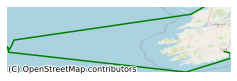
CE19014 - Monitoring Changes in Submarine Canyon Coral Habitats - Leg 2 (MoCha_Scan II) North East Atlantic Ocean 2019
Cold-water corals generate lush, structurally complex habitats in otherwise barren parts of the deep seabed. They trap particulates including particulate organic matter (POM) and sediment enabling them to develop bathymetric structures called reefs and mounds. This survey focuses on the maiden retrieval of 8 novel, ROV-adapted lander systems in the Porcupine Bank Canyon (PBC) coral habitats, NE Atlantic. CWC habitats have been mapped on the Irish margin over the past 20 years to progressively higher resolutions. In recent years, repeat mapping at consistently higher resolutions show that these habitats are dynamic and change has been quantified (sediment types, coral status and biodiversity). However, this drivers controlling this change has yet to be quantified or characterised. The main objective of this survey is to retrieve 8 lander systems that have been deployed in the PBC during CE19008 (MoCha_Scan Leg 1). These landers have been deployed for a period of approx. 2.5 months within a range of coral habitats throughout the PBC. They have been sampling particulates continuously and binned into 2.7 day bins. Current speed and direction have been measured in 20 m profiles from the lander for a period of 2 minutes every 10 minutes. Data recorded via landers from each habitat will allow to determine the controls on habitat variability and process thresholds. Furthermore, this data can be used as a baseline to which later deployments at this site will be used to compare against. Data will feed into a number of projects including: the H2020 project “Integrated Assessment of Atlantic Marine Ecosystems in Space and Time” (iATLANTIC) and the SFI-, GSI- and MI-funded “Mapping, Modelling and Monitoring Key Processes and Controls on Cold Water Coral Habitats in Submarine Canyons” (MMMonKey_Pro) programme. The main objective of this survey was to retrieve 8 lander systems that have been deployed in the during CE19008 (MoCha_Scan Leg 1).
Simple
- Date (Publication)
- 2021-06-29
- Date (Revision)
- 2023-06-01
- Date (Creation)
- 2021-06-29
- Citation identifier
- ie.marine.data:dataset.4660
- Point of contact
-
Organisation name Individual name Electronic mail address Role University College Cork
None
Originator
- Maintenance and update frequency
- As needed
- Use limitation
-
While every effort is made in preparing the dataset no responsibility is accepted by or on behalf of the Marine Institute for any errors, omissions or misleading information. The Marine Institute accepts no responsibility for loss or damage occasioned or claimed to have been occasioned, in part or in full, as a consequence of any person acting, or refraining from acting as a result of a matter contained in this datasets or as a consequence of using this dataset for any purpose whatsoever.
- Use limitation
-
A Creative Commons (CC) license is one of several public copyright licenses that enable the free distribution of an otherwise copyrighted work. A CC license is used when an author wants to give people the right to share, use, and build upon a work that they have created. Under Creative Commons CC BY 4.0 the following is granted: Rights Share — copy and redistribute the material in any medium or format; Adapt — remix, transform, and build upon the material for any purpose, even commercially. The licensor cannot revoke these freedoms as long as you follow the license terms. Requirements Attribution — You must give appropriate credit, provide a link to the license, and indicate if changes were made. You may do so in any reasonable manner, but not in any way that suggests the licensor endorses you or your use. No additional restrictions — You may not apply legal terms or technological measures that legally restrict others from doing anything the license permits.
- Access constraints
- CC%20BY%204.0
- Aggregate Datasetindentifier
- ie.marine.data:platform.33
- Association Type
- Cross reference
- Initiative Type
- Platform
- Aggregate Datasetindentifier
- ie.marine.data:dataset.4014
- Association Type
- Cross reference
- Initiative Type
- Collection
- Aggregate Datasetindentifier
- ie.marine.data:dataset.845
- Association Type
- Cross reference
- Initiative Type
- Collection
- Spatial representation type
- Grid
- Language
- English
- Begin date
- 2019-07-25
- End date
- 2019-07-31
))
- Reference system identifier
- INSPIRE RS registry / http://www.opengis.net/def/crs/EPSG/0/3857
- Distribution format
-
Name Version CSV Underway Data
CSV pCO2 Data
- OnLine resource
- OnLine resource
-
Protocol Linkage Name WWW:LINK-1.0-http--link
http://www.marine.ie
- Hierarchy level
- Dataset
Conformance result
- Title
-
Commission Regulation (EU) No 1089/2010 of 23 November 2010 implementing Directive 2007/2/EC of the European Parliament and of the Council as regards interoperability of spatial data sets and services
- Date (Publication)
- 2010-12-08
- Explanation
-
See the referenced specification
- Pass
- Yes
- Statement
-
Data supplied by Marine Institute.
Metadata
- File identifier
- ie.marine.data:dataset.4660 XML
- Metadata language
- English
- Hierarchy level
- Collection session
- Date stamp
- 2025-02-21T18:28:34.969502Z
- Metadata standard name
-
ISDI Metadata Profile
- Metadata standard version
-
1.2
- Metadata author
-
Organisation name Individual name Electronic mail address Role Marine Institute
Point of contact
)))
