 Irish Spatial Data Exchange
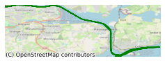
CV20002 Celtic Voyager Geographical Information Systems and Remote Sensing Cruise 2020 Celtic Sea
This 2 day training cruise was led by Galway Mayo Institute of Technology in Cork Harbour February 2020 on board the RV Celtic Voyager. The objective of the training programme was to present expertise from INFOMAR (The Integrated Mapping for the Sustainable Development of Ireland's Marine Resource and the National Centre for Geocomputation (NCG) at Maynooth University and deliver state of the art knowledge transfer of marine remote sensing technologies and knowledge transfer to an emerging cohort of geographers, geoscientists and GIS analysts. The cruise was based on the demonstrations of the Celtic Voyager's remote sampling data acquisition systems with data ground truthing. Grab and core sampling of the seabed was also carried out. The mini ROV wasn’t deployed due to weather conditions The purpose of this training cruise was to present expertise from INFOMAR and the National Centre for Geocomputation (NCG) at Maynooth University and deliver state of the art knowledge transfer of marine remote sensing technologies and knowledge transfer to an emerging cohort of geographers, geoscientists and GIS analysts.
Simple
- Date (Publication)
- 2021-01-22
- Date (Revision)
- 2021-01-22
- Date (Creation)
- 2021-01-22
- Citation identifier
- ie.marine.data:dataset.4439
- Point of contact
-
Organisation name Individual name Electronic mail address Role Atlantic Technological University
Originator
- Maintenance and update frequency
- As needed
- Use limitation
-
While every effort is made in preparing the dataset no responsibility is accepted by or on behalf of the Marine Institute for any errors, omissions or misleading information. The Marine Institute accepts no responsibility for loss or damage occasioned or claimed to have been occasioned, in part or in full, as a consequence of any person acting, or refraining from acting as a result of a matter contained in this datasets or as a consequence of using this dataset for any purpose whatsoever.
- Aggregate Datasetindentifier
- ie.marine.data:platform.34
- Association Type
- Cross reference
- Initiative Type
- Platform
- Spatial representation type
- Grid
- Language
- English
- Begin date
- 2020-02-14
- End date
- 2020-02-16
))
- Reference system identifier
- INSPIRE RS registry / http://www.opengis.net/def/crs/EPSG/0/3857
- Hierarchy level
- Dataset
Conformance result
- Title
-
Commission Regulation (EU) No 1089/2010 of 23 November 2010 implementing Directive 2007/2/EC of the European Parliament and of the Council as regards interoperability of spatial data sets and services
- Date (Publication)
- 2010-12-08
- Explanation
-
See the referenced specification
- Pass
- Yes
- Statement
-
Data supplied by Marine Institute.
Metadata
- File identifier
- ie.marine.data:dataset.4439 XML
- Metadata language
- English
- Hierarchy level
- Collection session
- Date stamp
- 2025-02-21T18:28:41.001392Z
- Metadata standard name
-
ISDI Metadata Profile
- Metadata standard version
-
1.2
- Metadata author
-
Organisation name Individual name Electronic mail address Role Marine Institute
Point of contact
)))
