 Irish Spatial Data Exchange
CE18015 SEA-SEIS-D (Structure, Evolution And Seismic hazard of the Irish offshore)
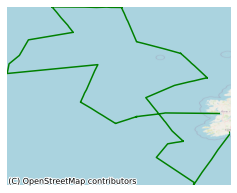
This survey, led by Dublin Institute for Advanced Studies (DIAS) (Geophysics section) took place in September/October 2018 on board the RV Celtic Explorer in the North East Atlantic Ocean. This survey was part of the SEA-SEIS project (Structure, Evolution And Seismicity of the Irish offshore) and will involve the deployment of ocean-bottom-seismometers that will sink and install themselves at the bottom of the seafloor at depths of 1-4 km in the North Atlantic Ocean. These record the tiny vibrations of the Earth caused by seismic waves, generated by earthquakes and by the ocean waves. During the survey a deep sea mooring was deployed, and the M6 weather buoy was also recovered. The DIAS OBS deployment survey is part of a new project "Structure, evolution and seismic hazard of the Irish offshore," funded by Science Foundation Ireland (SFI), Marine Institute and the Geological Survey Ireland and started on the 1st March, 2018. This survey was carried out to deploy broadband, ocean-bottom seismometers across Ireland’s offshore.
Simple
- Date (Publication)
- 2020-02-13
- Date (Revision)
- 2023-06-01
- Date (Creation)
- 2020-02-13
- Citation identifier
- ie.marine.data:dataset.4030
- Point of contact
-
Organisation name Individual name Electronic mail address Role Dublin Institute for Advanced Studies
Originator
- Maintenance and update frequency
- As needed
- Use limitation
-
While every effort is made in preparing the dataset no responsibility is accepted by or on behalf of the Marine Institute for any errors, omissions or misleading information. The Marine Institute accepts no responsibility for loss or damage occasioned or claimed to have been occasioned, in part or in full, as a consequence of any person acting, or refraining from acting as a result of a matter contained in this datasets or as a consequence of using this dataset for any purpose whatsoever.
- Use limitation
-
A Creative Commons (CC) license is one of several public copyright licenses that enable the free distribution of an otherwise copyrighted work. A CC license is used when an author wants to give people the right to share, use, and build upon a work that they have created. Under Creative Commons CC BY 4.0 the following is granted: Rights Share — copy and redistribute the material in any medium or format; Adapt — remix, transform, and build upon the material for any purpose, even commercially. The licensor cannot revoke these freedoms as long as you follow the license terms. Requirements Attribution — You must give appropriate credit, provide a link to the license, and indicate if changes were made. You may do so in any reasonable manner, but not in any way that suggests the licensor endorses you or your use. No additional restrictions — You may not apply legal terms or technological measures that legally restrict others from doing anything the license permits.
- Access constraints
- CC%20BY%204.0
- Aggregate Datasetindentifier
- ie.marine.data:platform.33
- Association Type
- Cross reference
- Initiative Type
- Platform
- Aggregate Datasetindentifier
- ie.marine.data:dataset.4014
- Association Type
- Cross reference
- Initiative Type
- Collection
- Aggregate Datasetindentifier
- ie.marine.data:dataset.845
- Association Type
- Cross reference
- Initiative Type
- Collection
- Spatial representation type
- Text, table
- Language
- English
- Begin date
- 2018-09-17
- End date
- 2018-10-20
))
- Reference system identifier
- INSPIRE RS registry / http://www.opengis.net/def/crs/EPSG/0/3857
- Distribution format
-
Name Version CSV Underway Data
CSV pCO2 Data
- OnLine resource
- OnLine resource
-
Protocol Linkage Name WWW:LINK-1.0-http--link
http://www.marine.ie
- OnLine resource
-
Protocol Linkage Name WWW:LINK-1.0-http--link
https://www.sfi.ie/funding/funding-calls/sfi-investigators-programme/
- Hierarchy level
- Dataset
Conformance result
- Title
-
Commission Regulation (EU) No 1089/2010 of 23 November 2010 implementing Directive 2007/2/EC of the European Parliament and of the Council as regards interoperability of spatial data sets and services
- Date (Publication)
- 2010-12-08
- Explanation
-
See the referenced specification
- Pass
- Yes
- Statement
-
Data supplied by Marine Institute.
Metadata
- File identifier
- ie.marine.data:dataset.4030 XML
- Metadata language
- English
- Hierarchy level
- Collection session
- Date stamp
- 2025-02-21T18:23:39.070842Z
- Metadata standard name
-
ISDI Metadata Profile
- Metadata standard version
-
1.2
- Metadata author
-
Organisation name Individual name Electronic mail address Role Marine Institute
Point of contact
)))
