 Irish Spatial Data Exchange
SmartBay Observatory Deployment Oct 2015 - December 2016
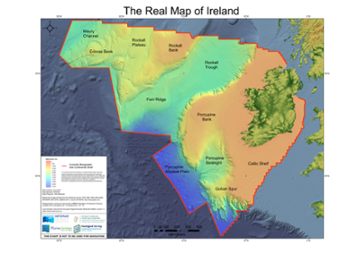
The SmartBay Observatory in Galway Bay is an underwater observatory which uses cameras, probes and sensors to permit continuous and remote live underwater monitoring. It was installed in 2015 on the seafloor 1.5km off the coast of Spiddal, Co. Galway, Ireland at a depth of 20-25m. Underwater observatories allow ocean researchers unique real-time access to monitor ongoing changes in the marine environment. The Galway Bay Observatory is an important contribution by Ireland to the growing global network of real-time data capture systems deployed in the ocean. Data relating to the marine environment at the Galway Observatory site is transferred in real-time through a fibre optic telecommunications cable to the Marine Institute headquarters and then made publicly available on the internet. The data includes a live video stream, the depth of the observatory node, the water temperature and salinity, and estimates of the chlorophyll and turbidity levels in the water which give an indication of the volume of phytoplankton and other particles, such as sediment, in the water. Maintenance takes place on the observatory every 18 to 24 months. The Observatory is equipped with a suite of sensors, these include: Acoustic Doppler Current Profiler (ADCP) - Teledyne RDI Workhorse Conductivity-Temperature-Depth (CTD) sensor probe - Idronaut Ocean-Seven 304 plus Acoustic data that have been collected from the Galway Observatory site using an icListen HF Smart Hydrophone Video data is streamed in near-real-time from the observatory and also available for download. A WetLabs ECO-FLNTU is installed on the observatory infrastructure. The Galway Bay Observatory is an important contribution by Ireland to the growing global network of real-time data capture systems deployed in the ocean. The purpose of this dataset is to measure and record water currents at the Wave Energy Test Site at an interval of 1m bins through the water column at depth of 25m. These data are used for scientific studies (e.g. Wind and Wave Climate, Marine Technology Development, Water Quality, Noise Environment) and environmental monitoring of the Galway Bay Marine Energy Test Site.
Simple
- Date (Publication)
- 2018-10-23
- Date (Revision)
- 2019-10-23
- Date (Creation)
- 2018-10-23
- Citation identifier
- ie.marine.data:dataset.2826
- Point of contact
-
Organisation name Individual name Electronic mail address Role Marine Institute
Originator
- Maintenance and update frequency
- As needed
- Use limitation
-
While every effort is made in preparing the dataset no responsibility is accepted by or on behalf of the Marine Institute for any errors, omissions or misleading information. The Marine Institute accepts no responsibility for loss or damage occasioned or claimed to have been occasioned, in part or in full, as a consequence of any person acting, or refraining from acting as a result of a matter contained in this datasets or as a consequence of using this dataset for any purpose whatsoever.
- Use limitation
-
A Creative Commons (CC) license is one of several public copyright licenses that enable the free distribution of an otherwise copyrighted work. A CC license is used when an author wants to give people the right to share, use, and build upon a work that they have created. Under Creative Commons CC BY 4.0 the following is granted: Rights Share — copy and redistribute the material in any medium or format; Adapt — remix, transform, and build upon the material for any purpose, even commercially. The licensor cannot revoke these freedoms as long as you follow the license terms. Requirements Attribution — You must give appropriate credit, provide a link to the license, and indicate if changes were made. You may do so in any reasonable manner, but not in any way that suggests the licensor endorses you or your use. No additional restrictions — You may not apply legal terms or technological measures that legally restrict others from doing anything the license permits.
- Access constraints
- CC%20BY%204.0
- Aggregate Datasetindentifier
- ie.marine.data:instrument.2821
- Association Type
- Cross reference
- Initiative Type
- Sensor
- Aggregate Datasetindentifier
- ie.marine.data:instrument.2835
- Association Type
- Cross reference
- Initiative Type
- Sensor
- Aggregate Datasetindentifier
- ie.marine.data:instrument.2936
- Association Type
- Cross reference
- Initiative Type
- Sensor
- Aggregate Datasetindentifier
- ie.marine.data:platform.2823
- Association Type
- Cross reference
- Initiative Type
- Platform
- Aggregate Datasetindentifier
- ie.marine.data:dataset.2816
- Association Type
- Cross reference
- Initiative Type
- Collection
- Aggregate Datasetindentifier
- ie.marine.data:dataset.2820
- Association Type
- Cross reference
- Initiative Type
- Collection
- Aggregate Datasetindentifier
- ie.marine.data:dataset.2837
- Association Type
- Cross reference
- Initiative Type
- Collection
- Aggregate Datasetindentifier
- ie.marine.data:dataset.2194
- Association Type
- Cross reference
- Initiative Type
- Collection
- Spatial representation type
- Grid
- Language
- English
- Begin date
- 2015-10-08
- End date
- 2016-12-12
))
- Reference system identifier
- INSPIRE RS registry / http://www.opengis.net/def/crs/EPSG/0/3857
- Distribution format
-
Name Version ASCII
HTML
- OnLine resource
-
Protocol Linkage Name WWW:DOWNLOAD-1.0-http--download
https://smartbay.marine.ie/data/hydrophones/SBF1323/ ASCII
- OnLine resource
-
Protocol Linkage Name WWW:DOWNLOAD-1.0-http--download
https://erddap.marine.ie/erddap/tabledap/spiddal_obs_ctd.html HTML
- OnLine resource
-
Protocol Linkage Name WWW:LINK-1.0-http--link
http://www.marine.ie
- OnLine resource
-
Protocol Linkage Name WWW:LINK-1.0-http--link
https://www.smartbay.ie/
- Hierarchy level
- Dataset
Conformance result
- Title
-
Commission Regulation (EU) No 1089/2010 of 23 November 2010 implementing Directive 2007/2/EC of the European Parliament and of the Council as regards interoperability of spatial data sets and services
- Date (Publication)
- 2010-12-08
- Explanation
-
See the referenced specification
- Pass
- Yes
- Statement
-
Data supplied by Marine Institute.
Metadata
- File identifier
- ie.marine.data:dataset.2826 XML
- Metadata language
- English
- Hierarchy level
- Collection session
- Date stamp
- 2025-02-21T18:23:40.483642Z
- Metadata standard name
-
ISDI Metadata Profile
- Metadata standard version
-
1.2
- Metadata author
-
Organisation name Individual name Electronic mail address Role Marine Institute
Point of contact
)))
