 Irish Spatial Data Exchange
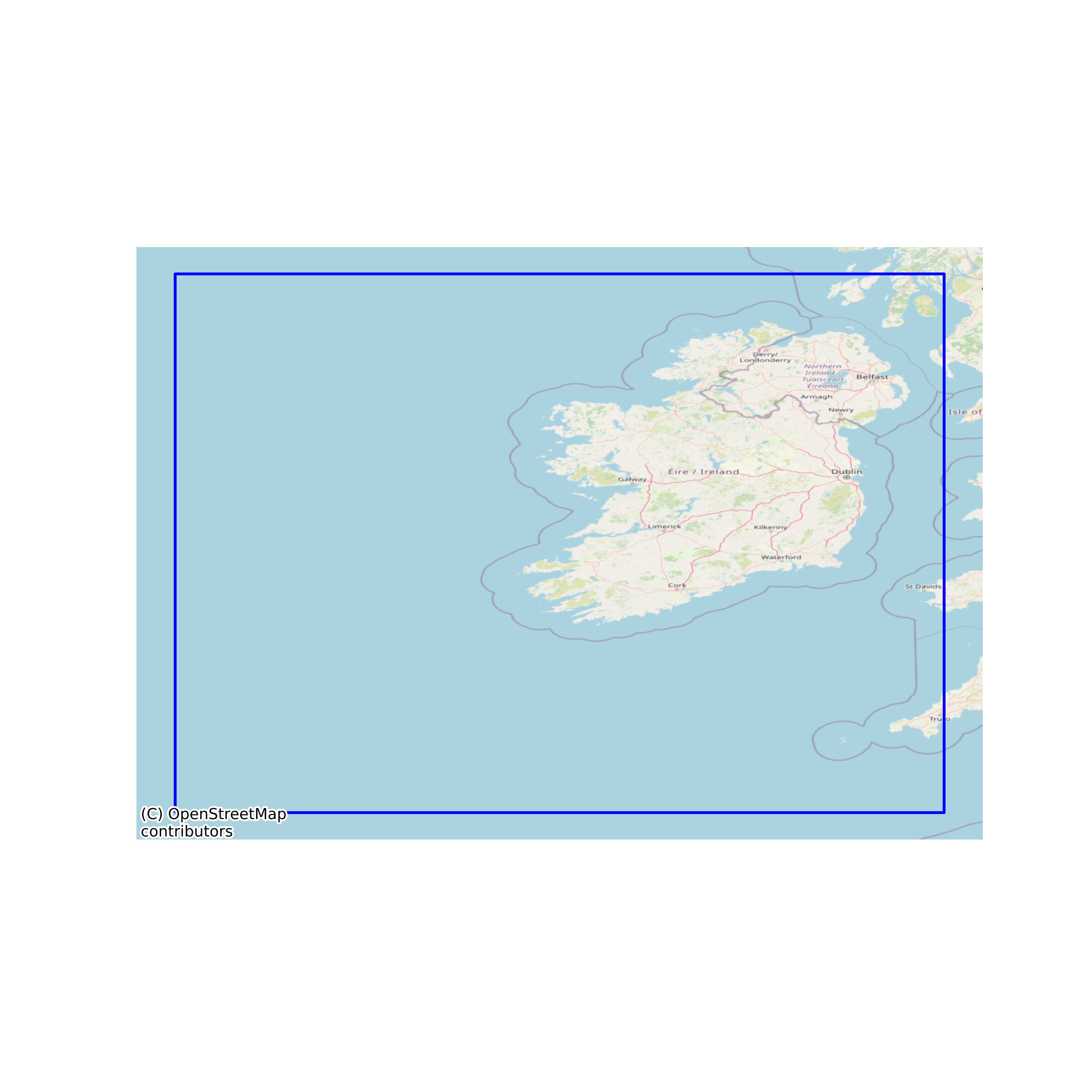
Irish Exclusive Economic Zone Maritime Boundary
An exclusive economic zone extends from the outer limit of the territorial sea to a maximum of 200 nautical miles (370.4 km; 230.2 mi) from the territorial sea baseline, thus it includes the contiguous zone. A coastal nation has control of all economic resources within its exclusive economic zone, including fishing, mining, oil exploration, and any pollution of those resources. However, it cannot prohibit passage or loitering above, on, or under the surface of the sea that is in compliance with the laws and regulations adopted by the coastal State in accordance with the provisions of the UN Convention, within that portion of its exclusive economic zone beyond its territorial sea. Before the United Nations Convention on the Law of the Sea of 1982, coastal nations arbitrarily extended their territorial waters in an effort to control activities which are now regulated by the exclusive economic zone, such as offshore oil exploration or fishing rights (see Cod Wars). Indeed, the exclusive economic zone is still popularly, though erroneously, called a coastal nation's territorial waters. None
Simple
- Date (Publication)
- 2018-02-01
- Date (Revision)
- 2023-06-01
- Date (Creation)
- 2018-02-01
- Citation identifier
- ie.marine.data:dataset.2139
- Point of contact
-
Organisation name Individual name Electronic mail address Role Petroleum Affairs Division
Originator
- Maintenance and update frequency
- As needed
- Use limitation
-
While every effort is made in preparing the dataset no responsibility is accepted by or on behalf of the Marine Institute for any errors, omissions or misleading information. The Marine Institute accepts no responsibility for loss or damage occasioned or claimed to have been occasioned, in part or in full, as a consequence of any person acting, or refraining from acting as a result of a matter contained in this datasets or as a consequence of using this dataset for any purpose whatsoever.
- Use limitation
-
A Creative Commons (CC) license is one of several public copyright licenses that enable the free distribution of an otherwise copyrighted work. A CC license is used when an author wants to give people the right to share, use, and build upon a work that they have created. Under Creative Commons CC BY 4.0 the following is granted: Rights Share — copy and redistribute the material in any medium or format; Adapt — remix, transform, and build upon the material for any purpose, even commercially. The licensor cannot revoke these freedoms as long as you follow the license terms. Requirements Attribution — You must give appropriate credit, provide a link to the license, and indicate if changes were made. You may do so in any reasonable manner, but not in any way that suggests the licensor endorses you or your use. No additional restrictions — You may not apply legal terms or technological measures that legally restrict others from doing anything the license permits.
- Access constraints
- CC%20BY%204.0
- Spatial representation type
- Vector
- Language
- English
- Begin date
- 2014-02-21
- End date
- ..
))
- Reference system identifier
- INSPIRE RS registry / http://www.opengis.net/def/crs/EPSG/0/3857
- Distribution format
-
Name Version CSV
KML
Shapefile
Web Map Service
- OnLine resource
-
Protocol Linkage Name WWW:DOWNLOAD-1.0-http--download
https://atlas.marine.ie/midata/AdministrativeUnits/Maritime_Boundary_Exclusive_Economic_Zone.csv.zip CSV
- OnLine resource
-
Protocol Linkage Name WWW:DOWNLOAD-1.0-http--download
https://atlas.marine.ie/midata/AdministrativeUnits/Maritime_Boundary_Exclusive_Economic_Zone.kml.zip KML
- OnLine resource
-
Protocol Linkage Name WWW:LINK-1.0-http--link
http://www.dccae.gov.ie/en-ie/natural-resources/topics/Oil-Gas-Exploration-Production/Pages/home.aspx
- OnLine resource
-
Protocol Linkage Name WWW:LINK-1.0-http--link
https://www.housing.gov.ie/planning/maritime-spatial-planning/maritime-spatial-planning-directive/maritime-spatial-planning
- OnLine resource
-
Protocol Linkage Name WWW:DOWNLOAD-1.0-http--download
https://atlas.marine.ie/midata/AdministrativeUnits/Maritime_Boundary_Exclusive_Economic_Zone.shapezip.zip Shapefile
- OnLine resource
-
Protocol Linkage Name OGC:WMS
https://atlas.marine.ie/arcgis/services/01_Maritime_Boundaries/MapServer/WMSServer?request=GetCapabilities&service=WMS Web Map Service
- Hierarchy level
- Dataset
Conformance result
- Title
-
Commission Regulation (EU) No 1089/2010 of 23 November 2010 implementing Directive 2007/2/EC of the European Parliament and of the Council as regards interoperability of spatial data sets and services
- Date (Publication)
- 2010-12-08
- Explanation
-
See the referenced specification
- Pass
- Yes
- Statement
-
Data supplied by Marine Institute.
Metadata
- File identifier
- ie.marine.data:dataset.2139 XML
- Metadata language
- English
- Hierarchy level
- Dataset
- Date stamp
- 2023-06-01
- Metadata standard name
-
ISDI Metadata Profile
- Metadata standard version
-
1.2
- Metadata author
-
Organisation name Individual name Electronic mail address Role Marine Institute
Point of contact
)))
