 Irish Spatial Data Exchange
CE13016 Celtic Explorer Methane Derived Authigenic Carbonate Survey (MDACS) 2013
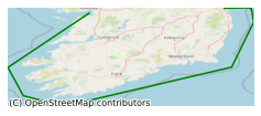
The European Commission Habitats Directive (92/43/EEC) required Member States to implement a range of measures including the monitoring of habitats for the protection of species listed in the Annexes of the Directive. One such habitat type listed in Annex l of this directive is Submarine Structures made by Leaking Gases (1180). These consist of structures such as sandstone slabs, pavements and pillars up to 4 m in height which are formed by aggregated carbonate cement resulting from microbial oxidation of gas emissions. There are a number of geological features within the Irish Sea which have formed in such a way as to lend themselves to the occurrence of accumulations, seepages and/or escapes of gas. This survey took place in February 2013 led by National Parks and Wildlife Service (NPWS) in conjunction with the Marine Institute (MI) on board the R.V. Celtic Explorer. The focus area was in the Irish Sea within the Kish Bank Basin, approximately 32km off shore in depths of between 50m to 80m using the under water tv (UWTV) camera. To record the occurrence of the Annex I habitat - Submarine Structures made by Leaking Gases (1180) in this area To record the fauna occurring on these features and the surrounding sediment using underwater camera and video To take epifaunal and substrate samples using Shipeck sampler.
Simple
- Date (Publication)
- 2018-01-11
- Date (Revision)
- 2021-02-25
- Date (Creation)
- 2018-01-11
- Citation identifier
- ie.marine.data:dataset.1892
- Point of contact
-
Organisation name Individual name Electronic mail address Role Marine Institute
Originator
- Maintenance and update frequency
- As needed
- Use limitation
-
While every effort is made in preparing the dataset no responsibility is accepted by or on behalf of the Marine Institute for any errors, omissions or misleading information. The Marine Institute accepts no responsibility for loss or damage occasioned or claimed to have been occasioned, in part or in full, as a consequence of any person acting, or refraining from acting as a result of a matter contained in this datasets or as a consequence of using this dataset for any purpose whatsoever.
- Use limitation
-
A Creative Commons (CC) license is one of several public copyright licenses that enable the free distribution of an otherwise copyrighted work. A CC license is used when an author wants to give people the right to share, use, and build upon a work that they have created. Under Creative Commons CC BY 4.0 the following is granted: Rights Share — copy and redistribute the material in any medium or format; Adapt — remix, transform, and build upon the material for any purpose, even commercially. The licensor cannot revoke these freedoms as long as you follow the license terms. Requirements Attribution — You must give appropriate credit, provide a link to the license, and indicate if changes were made. You may do so in any reasonable manner, but not in any way that suggests the licensor endorses you or your use. No additional restrictions — You may not apply legal terms or technological measures that legally restrict others from doing anything the license permits.
- Access constraints
- CC%20BY%204.0
- Aggregate Datasetindentifier
- ie.marine.data:instrument.45
- Association Type
- Cross reference
- Initiative Type
- Sensor
- Aggregate Datasetindentifier
- ie.marine.data:instrument.195
- Association Type
- Cross reference
- Initiative Type
- Sensor
- Aggregate Datasetindentifier
- ie.marine.data:instrument.198
- Association Type
- Cross reference
- Initiative Type
- Sensor
- Aggregate Datasetindentifier
- ie.marine.data:instrument.199
- Association Type
- Cross reference
- Initiative Type
- Sensor
- Aggregate Datasetindentifier
- ie.marine.data:platform.33
- Association Type
- Cross reference
- Initiative Type
- Platform
- Aggregate Datasetindentifier
- ie.marine.data:dataset.845
- Association Type
- Cross reference
- Initiative Type
- Collection
- Spatial representation type
- Grid
- Language
- English
- Begin date
- 2013-02-09
- End date
- 2013-02-13
))
- Reference system identifier
- INSPIRE RS registry / http://www.opengis.net/def/crs/EPSG/0/3857
- Distribution format
-
Name Version CSV Underway Data
- OnLine resource
-
Protocol Linkage Name WWW:LINK-1.0-http--link
http://www.marine.ie
- OnLine resource
-
Protocol Linkage Name WWW:LINK-1.0-http--link
http://www.seadatanet.org/
- Hierarchy level
- Dataset
Conformance result
- Title
-
Commission Regulation (EU) No 1089/2010 of 23 November 2010 implementing Directive 2007/2/EC of the European Parliament and of the Council as regards interoperability of spatial data sets and services
- Date (Publication)
- 2010-12-08
- Explanation
-
See the referenced specification
- Pass
- Yes
- Statement
-
Data supplied by Marine Institute.
Metadata
- File identifier
- ie.marine.data:dataset.1892 XML
- Metadata language
- English
- Hierarchy level
- Collection session
- Date stamp
- 2025-02-21T18:23:24.496538Z
- Metadata standard name
-
ISDI Metadata Profile
- Metadata standard version
-
1.2
- Metadata author
-
Organisation name Individual name Electronic mail address Role Marine Institute
Point of contact
)))
