 Irish Spatial Data Exchange
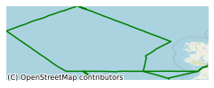
CE0903 Marine Institute Celtic Explorer Oceanographic Survey North East Atlantic Ocean 2009
In order to begin to collect key oceanographic data two dedicated research cruises are conducted annually in the Irish region. The foundation of these cruises is the acquisition of oceanographic data such as temperature, salinity, dissolved oxygen, fluorescence and ocean currents. A cross service group function was introduced by acquiring phytoplankton, zooplankton, and fish larva samples and gathering bathymetric data (including ground truthing samples) for the INFOMAR seabed mapping project. This inter-institutional and multi-disciplinary survey, led by the Marine Institute and National University of Ireland, Galway (NUIG), was conducted in February 2009 on board the R.V. Celtic Explorer. The main purpose of the cruise was to examine hydrographic conditions in Rockall Trough. A total of 43 stations were surveyed for a variety of parameters including CTDs (Conductivity-Temperature-Depth), grab samples and cores, nutrients, salinity and phytoplankton. Four ARGO floats were also deployed. The main purpose of the cruise was to examine hydrographic conditions in Rockall Trough. Objectives included: • Collect CTD profile data along the standard offshore sections to include: o Nutrient sampling o Phytoplankton and chlorophyll samples o Salinity samples • Collect grab samples at key locations on the Irish shelf • Collect opportunistic Vibro cores at sites in the vicinity of Porcupine and Rockall Bank. • Deploy 4 ARGO floats in the Rockall Trough • Collect zooplankton net hauls from around the Rockall Trough
Simple
- Date (Publication)
- 2018-01-08
- Date (Revision)
- 2021-03-01
- Date (Creation)
- 2018-01-08
- Citation identifier
- ie.marine.data:dataset.1784
- Point of contact
-
Organisation name Individual name Electronic mail address Role Marine Institute
Originator
- Maintenance and update frequency
- As needed
- Use limitation
-
While every effort is made in preparing the dataset no responsibility is accepted by or on behalf of the Marine Institute for any errors, omissions or misleading information. The Marine Institute accepts no responsibility for loss or damage occasioned or claimed to have been occasioned, in part or in full, as a consequence of any person acting, or refraining from acting as a result of a matter contained in this datasets or as a consequence of using this dataset for any purpose whatsoever.
- Use limitation
-
A Creative Commons (CC) license is one of several public copyright licenses that enable the free distribution of an otherwise copyrighted work. A CC license is used when an author wants to give people the right to share, use, and build upon a work that they have created. Under Creative Commons CC BY 4.0 the following is granted: Rights Share — copy and redistribute the material in any medium or format; Adapt — remix, transform, and build upon the material for any purpose, even commercially. The licensor cannot revoke these freedoms as long as you follow the license terms. Requirements Attribution — You must give appropriate credit, provide a link to the license, and indicate if changes were made. You may do so in any reasonable manner, but not in any way that suggests the licensor endorses you or your use. No additional restrictions — You may not apply legal terms or technological measures that legally restrict others from doing anything the license permits.
- Access constraints
- CC%20BY%204.0
- Aggregate Datasetindentifier
- ie.marine.data:instrument.45
- Association Type
- Cross reference
- Initiative Type
- Sensor
- Aggregate Datasetindentifier
- ie.marine.data:instrument.195
- Association Type
- Cross reference
- Initiative Type
- Sensor
- Aggregate Datasetindentifier
- ie.marine.data:instrument.198
- Association Type
- Cross reference
- Initiative Type
- Sensor
- Aggregate Datasetindentifier
- ie.marine.data:instrument.199
- Association Type
- Cross reference
- Initiative Type
- Sensor
- Aggregate Datasetindentifier
- ie.marine.data:platform.33
- Association Type
- Cross reference
- Initiative Type
- Platform
- Aggregate Datasetindentifier
- ie.marine.data:dataset.845
- Association Type
- Cross reference
- Initiative Type
- Collection
- Spatial representation type
- Grid
- Language
- English
- Begin date
- 2009-02-05
- End date
- 2009-02-15
))
- Reference system identifier
- INSPIRE RS registry / http://www.opengis.net/def/crs/EPSG/0/3857
- OnLine resource
-
Protocol Linkage Name WWW:LINK-1.0-http--link
http://www.marine.ie
- Hierarchy level
- Dataset
Conformance result
- Title
-
Commission Regulation (EU) No 1089/2010 of 23 November 2010 implementing Directive 2007/2/EC of the European Parliament and of the Council as regards interoperability of spatial data sets and services
- Date (Publication)
- 2010-12-08
- Explanation
-
See the referenced specification
- Pass
- Yes
- Statement
-
Data supplied by Marine Institute.
Metadata
- File identifier
- ie.marine.data:dataset.1784 XML
- Metadata language
- English
- Hierarchy level
- Collection session
- Date stamp
- 2025-02-21T18:14:50.530953Z
- Metadata standard name
-
ISDI Metadata Profile
- Metadata standard version
-
1.2
- Metadata author
-
Organisation name Individual name Electronic mail address Role Marine Institute
Point of contact
)))
