 Irish Spatial Data Exchange
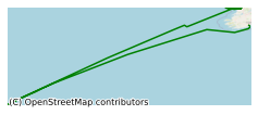
CE11009 Vents and Reefs (VENTuRE campaign) Survey
Vents and Reefs deep-sea ecosystem study of the 45o North MAR hydrothermal vent field and the cold-water coral Moira Mounds, Porcupine Seabight . This survey took place on board the R.V. Celtic Explorer in July/Augyst 2011 along the mid-Atlantic ridge, led by University College Cork and focuses on two distinct deep-water biogeological systems - hydrothermal vents and cold-water coral reefs. Hydrothermal vents play a key role in replenishing depleted elements in the oceans, supporting unique chemosynthetic ecosystems and depositing ore-grade metal sulphides. Cold-water coral reefs are biodiversity hotspots on continental margins and preserve a unique high resolution geological record of intermediate water depth environmental and climate change. This was a discovery and exploration cruise to document previously undiscovered examples of these important bio-geological systems. Surveys were conducted using the ROV Holland 1. In order to determine the location of high-temperature hydrothermal venting on the seafloor and subsequently obtain water samples for plume studies, 14 CTD deployments were undertaken. Reef areas were mapped with high resolution multibeam. Two geological settings were sampled: ROV based sampling of the active vent site sulphides and surrounding mafic rocks, and dredge based sampling of two flat-topped seamounts. Specific objectives: Our programme has the following specific objectives: 1) Verify the status of reef growth and coral health in the Moira Mound extension field. 2) To study the off-reef and within-reef sedimentary environment to provide evidence for current flow and sediment transport affecting reef development. 3) To study cold-water coral reef biodiversity and sample fauna for ongoing biodiscovery research. 4) To locate the source of active high-temperature hydrothermal fluid venting on the Mid-Atlantic Ridge at 45°N and hence discover the first deep-water hydrothermal vent between the Azores and Iceland 5) To determine and map the geological setting, geochemistry and history of hydrothermal activity of the vent field at 45°N. 6) To characterise MAR macrofaunal communities at the study site by visual, morphological and molecular means, to identify new taxa and establish a sample reference collection. 7) To establish the phylogenetic, phylogeographic or population genetic affinities of the fauna at 45°N, revealing the influences of hydrography, geological history and isolation on vent biogeography. 8) To test whether the vent community at 45°N belongs to a new biogeographic province of chemosynthetic fauna; 9) To elucidate the consequences of isolation on the life-history biologies of taxa shared between 45°N and other known vents, through analysis of their gametogenic development; 10) Isotopic analyses of biomass dominant taxa to elucidate trophic structure; 11) To collect samples of potentially novel organisms for the marine biotechnology community/biodiscovery programme.
Simple
- Date (Publication)
- 2018-01-04
- Date (Revision)
- 2023-06-01
- Date (Creation)
- 2018-01-04
- Citation identifier
- ie.marine.data:dataset.1741
- Point of contact
-
Organisation name Individual name Electronic mail address Role University College Cork
None
Originator
- Maintenance and update frequency
- As needed
- Use limitation
-
While every effort is made in preparing the dataset no responsibility is accepted by or on behalf of the Marine Institute for any errors, omissions or misleading information. The Marine Institute accepts no responsibility for loss or damage occasioned or claimed to have been occasioned, in part or in full, as a consequence of any person acting, or refraining from acting as a result of a matter contained in this datasets or as a consequence of using this dataset for any purpose whatsoever.
- Use limitation
-
A Creative Commons (CC) license is one of several public copyright licenses that enable the free distribution of an otherwise copyrighted work. A CC license is used when an author wants to give people the right to share, use, and build upon a work that they have created. Under Creative Commons CC BY 4.0 the following is granted: Rights Share — copy and redistribute the material in any medium or format; Adapt — remix, transform, and build upon the material for any purpose, even commercially. The licensor cannot revoke these freedoms as long as you follow the license terms. Requirements Attribution — You must give appropriate credit, provide a link to the license, and indicate if changes were made. You may do so in any reasonable manner, but not in any way that suggests the licensor endorses you or your use. No additional restrictions — You may not apply legal terms or technological measures that legally restrict others from doing anything the license permits.
- Access constraints
- CC%20BY%204.0
- Aggregate Datasetindentifier
- ie.marine.data:instrument.45
- Association Type
- Cross reference
- Initiative Type
- Sensor
- Aggregate Datasetindentifier
- ie.marine.data:instrument.195
- Association Type
- Cross reference
- Initiative Type
- Sensor
- Aggregate Datasetindentifier
- ie.marine.data:instrument.198
- Association Type
- Cross reference
- Initiative Type
- Sensor
- Aggregate Datasetindentifier
- ie.marine.data:instrument.199
- Association Type
- Cross reference
- Initiative Type
- Sensor
- Aggregate Datasetindentifier
- ie.marine.data:platform.33
- Association Type
- Cross reference
- Initiative Type
- Platform
- Aggregate Datasetindentifier
- ie.marine.data:dataset.845
- Association Type
- Cross reference
- Initiative Type
- Collection
- Spatial representation type
- Grid
- Language
- English
- Begin date
- 2011-07-11
- End date
- 2011-08-04
))
- Reference system identifier
- INSPIRE RS registry / http://www.opengis.net/def/crs/EPSG/0/3857
- Distribution format
-
Name Version CSV Underway Data
- OnLine resource
-
Protocol Linkage Name WWW:LINK-1.0-http--link
http://www.marine.ie
- OnLine resource
-
Protocol Linkage Name WWW:LINK-1.0-http--link
http://www.seadatanet.org/
- Hierarchy level
- Dataset
Conformance result
- Title
-
Commission Regulation (EU) No 1089/2010 of 23 November 2010 implementing Directive 2007/2/EC of the European Parliament and of the Council as regards interoperability of spatial data sets and services
- Date (Publication)
- 2010-12-08
- Explanation
-
See the referenced specification
- Pass
- Yes
- Statement
-
Data supplied by Marine Institute.
Metadata
- File identifier
- ie.marine.data:dataset.1741 XML
- Metadata language
- English
- Hierarchy level
- Collection session
- Date stamp
- 2025-02-21T18:15:02.488634Z
- Metadata standard name
-
ISDI Metadata Profile
- Metadata standard version
-
1.2
- Metadata author
-
Organisation name Individual name Electronic mail address Role Marine Institute
Point of contact
)))
