 Irish Spatial Data Exchange
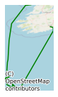
CE11006 Celtic Explorer Biodiscovery and Deep-ocean Ecosystems Survey 2011
This planned biodiscovery and deep-ocean ecosystems cruise cancelled due to vessel issues. This is a multidisciplinary deep-sea research cruise, combining two components: biodiscovery, and ecosystem functioning and nutrient recycling. Both components are inter-institutional and interdisciplinary. The scientific objectives of the two components are as follows: [1] Biodiscovery Working on the lower slope and at bathyal/abyssal depths in canyon regions we aim to: (i) Identify and map benthic macrofauna using conventional cores and ROV surveys (ii) Improve systematic knowledge of Porifera and Mollusca (iii) Collect specimens for the MI Marine Biodiscovery Laboratory (iv) Collect specimens likely to have novel photoactive molecules (v) Characterise bacterial and archaeal diversity in water and sediment (vi) Collect marine invertebrates (particularly sponges), seawater, and sediment to study and compare the microbiota associated with each of the samples, culture microorganisms and construct metagenomic libraries. [2] Ecosystem function and nutrient cycling We aim to: (i) Examine the mechanisms whereby biogenic material, essentially derived for the spring diatom bloom and deposited on the continental shelf, is advected into layers within the open ocean water column from whence it sinks to the sea bed; (ii) Delineate the advective extent of these nepheloid layers of biogenic material derived from the continental shelf; (iii) Detect and determine the diversity and abundance of deep-sea nitrogen cycling microorganisms; (iv) Characterise and determine the origins, lability and recycling rates of dissolved and particulate organic matter supporting the currently accepted net heterotrophic nature of deep-sea cold-water coral reef communities; (v) Collect calcifying detritivores, Lophelia branches, coral rubble and sediment to study the transfer of C and N through the detritivore foodweb; and (vi) Determine mixing and resuspension rates at the sediment water interface using natural radiotracers.
Simple
- Date (Publication)
- 2018-01-04
- Date (Revision)
- 2021-03-02
- Date (Creation)
- 2018-01-04
- Citation identifier
- ie.marine.data:dataset.1730
- Point of contact
-
Organisation name Individual name Electronic mail address Role University of Galway
Originator
- Maintenance and update frequency
- As needed
- Use limitation
-
While every effort is made in preparing the dataset no responsibility is accepted by or on behalf of the Marine Institute for any errors, omissions or misleading information. The Marine Institute accepts no responsibility for loss or damage occasioned or claimed to have been occasioned, in part or in full, as a consequence of any person acting, or refraining from acting as a result of a matter contained in this datasets or as a consequence of using this dataset for any purpose whatsoever.
- Use limitation
-
A Creative Commons (CC) license is one of several public copyright licenses that enable the free distribution of an otherwise copyrighted work. A CC license is used when an author wants to give people the right to share, use, and build upon a work that they have created. Under Creative Commons CC BY 4.0 the following is granted: Rights Share — copy and redistribute the material in any medium or format; Adapt — remix, transform, and build upon the material for any purpose, even commercially. The licensor cannot revoke these freedoms as long as you follow the license terms. Requirements Attribution — You must give appropriate credit, provide a link to the license, and indicate if changes were made. You may do so in any reasonable manner, but not in any way that suggests the licensor endorses you or your use. No additional restrictions — You may not apply legal terms or technological measures that legally restrict others from doing anything the license permits.
- Access constraints
- CC%20BY%204.0
- Aggregate Datasetindentifier
- ie.marine.data:instrument.45
- Association Type
- Cross reference
- Initiative Type
- Sensor
- Aggregate Datasetindentifier
- ie.marine.data:instrument.195
- Association Type
- Cross reference
- Initiative Type
- Sensor
- Aggregate Datasetindentifier
- ie.marine.data:instrument.198
- Association Type
- Cross reference
- Initiative Type
- Sensor
- Aggregate Datasetindentifier
- ie.marine.data:instrument.199
- Association Type
- Cross reference
- Initiative Type
- Sensor
- Aggregate Datasetindentifier
- ie.marine.data:platform.33
- Association Type
- Cross reference
- Initiative Type
- Platform
- Aggregate Datasetindentifier
- ie.marine.data:dataset.845
- Association Type
- Cross reference
- Initiative Type
- Collection
- Spatial representation type
- Grid
- Language
- English
- Begin date
- 2011-04-20
- End date
- 2011-05-10
))
- Reference system identifier
- INSPIRE RS registry / http://www.opengis.net/def/crs/EPSG/0/3857
- Distribution format
-
Name Version CSV Underway Data
- OnLine resource
-
Protocol Linkage Name WWW:LINK-1.0-http--link
http://www.marine.ie
- OnLine resource
-
Protocol Linkage Name WWW:LINK-1.0-http--link
http://www.seadatanet.org/
- Hierarchy level
- Dataset
Conformance result
- Title
-
Commission Regulation (EU) No 1089/2010 of 23 November 2010 implementing Directive 2007/2/EC of the European Parliament and of the Council as regards interoperability of spatial data sets and services
- Date (Publication)
- 2010-12-08
- Explanation
-
See the referenced specification
- Pass
- Yes
- Statement
-
Data supplied by Marine Institute.
Metadata
- File identifier
- ie.marine.data:dataset.1730 XML
- Metadata language
- English
- Hierarchy level
- Collection session
- Date stamp
- 2025-02-21T18:14:33.045346Z
- Metadata standard name
-
ISDI Metadata Profile
- Metadata standard version
-
1.2
- Metadata author
-
Organisation name Individual name Electronic mail address Role Marine Institute
Point of contact
)))
