 Irish Spatial Data Exchange
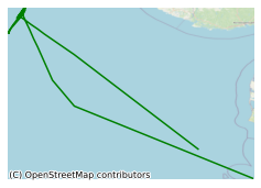
CE12010 ECO2@NorthSea
Night time activity will mainly consist of the following: Deployments of a video-guided Pump-CTD connected to Membrane Inlet Mass Spectrometry. Hydroacoustic detection of gas bubbles using single/split beam echo sounders. The following activity will largely be undertaken during day time : Deployment of landers to perform in situ gas flux measurements. Deployment of ROV Kiel 6000 for detailed sampling of sediments and deployment of instruments on the seafloor. Deployment of a vibrocorer for recovery of long sediment cores for porewater analysis. (10 cores total) On the cruise, proposed here, we wish to investigate the Sleipner CO2 storage site operated by Statoil and the blow out site in UK waters . We intend to quantify fluxes of key chemical parameters and potentially toxic metals and study the mechanisms determining the migration of CO2, CH4, and formation waters through the sedimentary overburden by a variety of novel monitoring techniques. Included in the study are investigations of seawater chemistry together with the near-field dispersion processes as key input parameters for our environmental studies and numerical model simulations. We will also carry out the assessment of the distribution of sensitive megafauna and will use fingerprinting of microbial community diversity as a key indicator of environmental impacts (for more details see the uploaded scientific project description).
Simple
- Date (Publication)
- 2018-01-04
- Date (Revision)
- 2018-11-29
- Date (Creation)
- 2018-01-04
- Citation identifier
- ie.marine.data:dataset.1703
- Point of contact
-
Organisation name Individual name Electronic mail address Role Helmholtz Centre for Ocean Research Kiel
Originator
- Maintenance and update frequency
- As needed
- Use limitation
-
While every effort is made in preparing the dataset no responsibility is accepted by or on behalf of the Marine Institute for any errors, omissions or misleading information. The Marine Institute accepts no responsibility for loss or damage occasioned or claimed to have been occasioned, in part or in full, as a consequence of any person acting, or refraining from acting as a result of a matter contained in this datasets or as a consequence of using this dataset for any purpose whatsoever.
- Use limitation
-
A Creative Commons (CC) license is one of several public copyright licenses that enable the free distribution of an otherwise copyrighted work. A CC license is used when an author wants to give people the right to share, use, and build upon a work that they have created. Under Creative Commons CC BY 4.0 the following is granted: Rights Share — copy and redistribute the material in any medium or format; Adapt — remix, transform, and build upon the material for any purpose, even commercially. The licensor cannot revoke these freedoms as long as you follow the license terms. Requirements Attribution — You must give appropriate credit, provide a link to the license, and indicate if changes were made. You may do so in any reasonable manner, but not in any way that suggests the licensor endorses you or your use. No additional restrictions — You may not apply legal terms or technological measures that legally restrict others from doing anything the license permits.
- Access constraints
- CC%20BY%204.0
- Aggregate Datasetindentifier
- ie.marine.data:instrument.45
- Association Type
- Cross reference
- Initiative Type
- Sensor
- Aggregate Datasetindentifier
- ie.marine.data:instrument.195
- Association Type
- Cross reference
- Initiative Type
- Sensor
- Aggregate Datasetindentifier
- ie.marine.data:instrument.198
- Association Type
- Cross reference
- Initiative Type
- Sensor
- Aggregate Datasetindentifier
- ie.marine.data:instrument.199
- Association Type
- Cross reference
- Initiative Type
- Sensor
- Aggregate Datasetindentifier
- ie.marine.data:platform.33
- Association Type
- Cross reference
- Initiative Type
- Platform
- Aggregate Datasetindentifier
- ie.marine.data:dataset.845
- Association Type
- Cross reference
- Initiative Type
- Collection
- Spatial representation type
- Grid
- Language
- English
- Begin date
- 2012-07-19
- End date
- 2012-08-06
))
- Reference system identifier
- INSPIRE RS registry / http://www.opengis.net/def/crs/EPSG/0/3857
- Distribution format
-
Name Version CSV Underway Data
- OnLine resource
-
Protocol Linkage Name WWW:LINK-1.0-http--link
http://www.marine.ie
- OnLine resource
-
Protocol Linkage Name WWW:LINK-1.0-http--link
http://www.seadatanet.org/
- Hierarchy level
- Dataset
Conformance result
- Title
-
Commission Regulation (EU) No 1089/2010 of 23 November 2010 implementing Directive 2007/2/EC of the European Parliament and of the Council as regards interoperability of spatial data sets and services
- Date (Publication)
- 2010-12-08
- Explanation
-
See the referenced specification
- Pass
- Yes
- Statement
-
Data supplied by Marine Institute.
Metadata
- File identifier
- ie.marine.data:dataset.1703 XML
- Metadata language
- English
- Hierarchy level
- Collection session
- Date stamp
- 2025-02-21T18:14:33.571705Z
- Metadata standard name
-
ISDI Metadata Profile
- Metadata standard version
-
1.2
- Metadata author
-
Organisation name Individual name Electronic mail address Role Marine Institute
Point of contact
)))
