 Irish Spatial Data Exchange
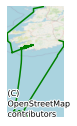
CE14003 GATEWAYS II Survey
Possible deployment of vibrocoring equipment. Night time coring will only be envisaged if adverse weather conditions severely hamper core recovery during day time operations. Primarily, this application proposes to collect cores from and seismic imaging data of the sediments and landforms deposited in an important marginal zone of the last British Irish Ice Sheet (BIIS). The region features highly in models of ‘ice streaming’ within the last BIIS. The sites will be specifically chosen to ground truth data collected in 2009 during the Italian GLAMAR cruise (PI Dr Daniel Praeg, a co-applicant currently based at OGS, Trieste), and legacy data and core locations of the BGS (Dr Dayton Dove, BGS Edinburgh, is also a co-applicant). To achieve this, sediments will be collected from locations with high probabilities of allowing a new, robust and internationally importnant glacial stratigraphic framework to be developed for these areas. The data collected will form important components of tests for critical hypotheses regarding ice extents and ice stream formation. This proposal builds on the work already conducted in one of the proposed survey areas under the auspices of the Italian led GLAMAR mission and the PI’s INFOMAR funded RIDGES project (closed and reported on in Nov. 2010/Jan 2011 respectively). It also compliments all the work being done on the glacial history of the Irish western shallow shelf (including the PI’s INFOMAR funded EIMeR and RIDGES projects) and the intended investigation of the same issues by the NERC funded BRITICE-CHRONO project which actively supports this application (B-C Theme Leader (Marine Geology) Prof. Colm O’Cofaigh is a co-applicant). The cruise will also aim to collect MBES and UWTV groundtruthing samples for use within the Geological Survey’s seabed substrate characterisation research (led by Mr X. Monteys and Dr. Gill Scott, also NUIM) in collaboration with Dr Colm Lordan, MI Fisheries Science Services.
Simple
- Date (Publication)
- 2018-01-03
- Date (Revision)
- 2023-06-01
- Date (Creation)
- 2018-01-03
- Citation identifier
- ie.marine.data:dataset.1622
- Point of contact
-
Organisation name Individual name Electronic mail address Role Marine Institute
Originator
- Maintenance and update frequency
- As needed
- Use limitation
-
While every effort is made in preparing the dataset no responsibility is accepted by or on behalf of the Marine Institute for any errors, omissions or misleading information. The Marine Institute accepts no responsibility for loss or damage occasioned or claimed to have been occasioned, in part or in full, as a consequence of any person acting, or refraining from acting as a result of a matter contained in this datasets or as a consequence of using this dataset for any purpose whatsoever.
- Use limitation
-
A Creative Commons (CC) license is one of several public copyright licenses that enable the free distribution of an otherwise copyrighted work. A CC license is used when an author wants to give people the right to share, use, and build upon a work that they have created. Under Creative Commons CC BY 4.0 the following is granted: Rights Share — copy and redistribute the material in any medium or format; Adapt — remix, transform, and build upon the material for any purpose, even commercially. The licensor cannot revoke these freedoms as long as you follow the license terms. Requirements Attribution — You must give appropriate credit, provide a link to the license, and indicate if changes were made. You may do so in any reasonable manner, but not in any way that suggests the licensor endorses you or your use. No additional restrictions — You may not apply legal terms or technological measures that legally restrict others from doing anything the license permits.
- Access constraints
- CC%20BY%204.0
- Aggregate Datasetindentifier
- ie.marine.data:instrument.45
- Association Type
- Cross reference
- Initiative Type
- Sensor
- Aggregate Datasetindentifier
- ie.marine.data:instrument.195
- Association Type
- Cross reference
- Initiative Type
- Sensor
- Aggregate Datasetindentifier
- ie.marine.data:instrument.198
- Association Type
- Cross reference
- Initiative Type
- Sensor
- Aggregate Datasetindentifier
- ie.marine.data:instrument.199
- Association Type
- Cross reference
- Initiative Type
- Sensor
- Aggregate Datasetindentifier
- ie.marine.data:platform.33
- Association Type
- Cross reference
- Initiative Type
- Platform
- Aggregate Datasetindentifier
- ie.marine.data:dataset.845
- Association Type
- Cross reference
- Initiative Type
- Collection
- Spatial representation type
- Grid
- Language
- English
- Begin date
- 2014-02-22
- End date
- 2014-03-05
))
- Reference system identifier
- INSPIRE RS registry / http://www.opengis.net/def/crs/EPSG/0/3857
- Distribution format
-
Name Version CSV Underway Data
- OnLine resource
-
Protocol Linkage Name WWW:LINK-1.0-http--link
http://www.marine.ie
- OnLine resource
-
Protocol Linkage Name WWW:LINK-1.0-http--link
http://www.seadatanet.org/
- Hierarchy level
- Dataset
Conformance result
- Title
-
Commission Regulation (EU) No 1089/2010 of 23 November 2010 implementing Directive 2007/2/EC of the European Parliament and of the Council as regards interoperability of spatial data sets and services
- Date (Publication)
- 2010-12-08
- Explanation
-
See the referenced specification
- Pass
- Yes
- Statement
-
Data supplied by Marine Institute.
Metadata
- File identifier
- ie.marine.data:dataset.1622 XML
- Metadata language
- English
- Hierarchy level
- Collection session
- Date stamp
- 2025-02-21T18:14:43.295498Z
- Metadata standard name
-
ISDI Metadata Profile
- Metadata standard version
-
1.2
- Metadata author
-
Organisation name Individual name Electronic mail address Role Marine Institute
Point of contact
)))
