 Irish Spatial Data Exchange
CE15009 QuERCi QUantifying EnviRonmental Controls on cold-water coral reef growth survey
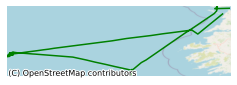
This survey, led by University College Cork (UCC), took place on board the Marine Institute's R.V. Celtic Explorer in June 2015. The survey was carried out to study cold-water coral reefs in two different Special Areas of Conservation (SACs), the Belgica Mound SAC and the Porcupine Bank Canyon SAC, in differing seabed contexts. This survey produced new mapping coverages of the Moira Mounds whose location, distribution and abundance were vaguely known previously. Groundtruthing using ROV (Holland 1) inspection verified the maps. Reconnaisance mapping of the number of cold-water coral reef mounds was carried out. The ROV was used to record video footage of the corals. CTD (Conductivity, Temperature and Depth) profiles obtained and gravity core sampling carried out to quantitatively investigate biomineralized microfauna, coupled with geochemical analyses. The main purpose of the survey was to - elucidate and quantify the abiotic (allogenic) controls on cold-water reef development in Irish waters and in general. Two distinct settings were focued on: the Moira Mounds (Belgica Mound province) and the Porcupine Bank Canyon Mounds. - evaluate the status of cold-water coral reefs in these two SAC to increase our understanding of the habitat; in the Porcupine Bank Canyon SAC this will be the first detailed investigation. - define and extend the known geographic distribution of cold-water coral reefs (Moira Mounds) in the Belgica Mound Province beyond the SAC and existing high resolution map coverages.
Simple
- Date (Publication)
- 2018-01-02
- Date (Revision)
- 2018-11-29
- Date (Creation)
- 2018-01-02
- Citation identifier
- ie.marine.data:dataset.1602
- Point of contact
-
Organisation name Individual name Electronic mail address Role University College Cork
None
Originator
- Maintenance and update frequency
- As needed
- Use limitation
-
While every effort is made in preparing the dataset no responsibility is accepted by or on behalf of the Marine Institute for any errors, omissions or misleading information. The Marine Institute accepts no responsibility for loss or damage occasioned or claimed to have been occasioned, in part or in full, as a consequence of any person acting, or refraining from acting as a result of a matter contained in this datasets or as a consequence of using this dataset for any purpose whatsoever.
- Use limitation
-
A Creative Commons (CC) license is one of several public copyright licenses that enable the free distribution of an otherwise copyrighted work. A CC license is used when an author wants to give people the right to share, use, and build upon a work that they have created. Under Creative Commons CC BY 4.0 the following is granted: Rights Share — copy and redistribute the material in any medium or format; Adapt — remix, transform, and build upon the material for any purpose, even commercially. The licensor cannot revoke these freedoms as long as you follow the license terms. Requirements Attribution — You must give appropriate credit, provide a link to the license, and indicate if changes were made. You may do so in any reasonable manner, but not in any way that suggests the licensor endorses you or your use. No additional restrictions — You may not apply legal terms or technological measures that legally restrict others from doing anything the license permits.
- Access constraints
- CC%20BY%204.0
- Aggregate Datasetindentifier
- ie.marine.data:platform.33
- Association Type
- Cross reference
- Initiative Type
- Platform
- Aggregate Datasetindentifier
- ie.marine.data:dataset.845
- Association Type
- Cross reference
- Initiative Type
- Collection
- Spatial representation type
- Grid
- Language
- English
- Begin date
- 2015-06-09
- End date
- 2015-06-23
))
- Reference system identifier
- INSPIRE RS registry / http://www.opengis.net/def/crs/EPSG/0/3857
- Distribution format
-
Name Version CSV Underway Data
- OnLine resource
-
Protocol Linkage Name WWW:LINK-1.0-http--link
http://www.marine.ie
- OnLine resource
-
Protocol Linkage Name WWW:LINK-1.0-http--link
http://www.seadatanet.org/
- Hierarchy level
- Dataset
Conformance result
- Title
-
Commission Regulation (EU) No 1089/2010 of 23 November 2010 implementing Directive 2007/2/EC of the European Parliament and of the Council as regards interoperability of spatial data sets and services
- Date (Publication)
- 2010-12-08
- Explanation
-
See the referenced specification
- Pass
- Yes
- Statement
-
Data supplied by Marine Institute.
Metadata
- File identifier
- ie.marine.data:dataset.1602 XML
- Metadata language
- English
- Hierarchy level
- Collection session
- Date stamp
- 2025-02-21T18:14:46.502396Z
- Metadata standard name
-
ISDI Metadata Profile
- Metadata standard version
-
1.2
- Metadata author
-
Organisation name Individual name Electronic mail address Role Marine Institute
Point of contact
)))
