 Irish Spatial Data Exchange
CE16015 Shallow Sub-Seabed Seismic Stratigraphic Survey (QuERCi II)
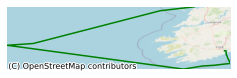
This survey is a follow up to the Quantifying EnviRonmental Controls on Cold-water coral Reef Growth (QuERCi) survey which investigated cold-water coral mounds on the southern lip of the Porcupine Bank Canyon and discovered an extensive field of corals attached to the near-vertical rock face on the upper canyon flank. QuERCi and QuERCi_II aim to understand the role of cold-water corals in canyon processes, map and explore the coral and canyon floor habitats and collect sample to assess temporal changes in the canyon environment. This survey took place in May 2016 on board the R.V. Celtic Explorer in the North East Atlantic Ocean (the Porcupine Bank Canyon). Shipbased multibeam coverage of the area was extended on the previous survey, attempts to collect gravity cores were conducted, however operations were unsuccessful (with the exception of core catcher retrievals) on all mound, slope and within canyon sites. Two Holland I ROV dives were completed to collect coral samples and further explore the Porcupine Bank Canyon coral habitat. A Marine Mammal Observer (MMO) was onboard to record marine mammal sightings. - Further evaluate the status of cold-water coral reefs in the Porcupine Bank Canyon Special Area of Conservation (SAC) - Assess faunal distributions on the steep canyon wall habitats - Conduct visual surveys for cetaceans
Simple
- Date (Publication)
- 2018-01-02
- Date (Revision)
- 2018-11-29
- Date (Creation)
- 2018-01-02
- Citation identifier
- ie.marine.data:dataset.1587
- Point of contact
-
Organisation name Individual name Electronic mail address Role Marine Institute
Originator
- Maintenance and update frequency
- As needed
- Use limitation
-
While every effort is made in preparing the dataset no responsibility is accepted by or on behalf of the Marine Institute for any errors, omissions or misleading information. The Marine Institute accepts no responsibility for loss or damage occasioned or claimed to have been occasioned, in part or in full, as a consequence of any person acting, or refraining from acting as a result of a matter contained in this datasets or as a consequence of using this dataset for any purpose whatsoever.
- Use limitation
-
A Creative Commons (CC) license is one of several public copyright licenses that enable the free distribution of an otherwise copyrighted work. A CC license is used when an author wants to give people the right to share, use, and build upon a work that they have created. Under Creative Commons CC BY 4.0 the following is granted: Rights Share — copy and redistribute the material in any medium or format; Adapt — remix, transform, and build upon the material for any purpose, even commercially. The licensor cannot revoke these freedoms as long as you follow the license terms. Requirements Attribution — You must give appropriate credit, provide a link to the license, and indicate if changes were made. You may do so in any reasonable manner, but not in any way that suggests the licensor endorses you or your use. No additional restrictions — You may not apply legal terms or technological measures that legally restrict others from doing anything the license permits.
- Access constraints
- CC%20BY%204.0
- Aggregate Datasetindentifier
- ie.marine.data:instrument.45
- Association Type
- Cross reference
- Initiative Type
- Sensor
- Aggregate Datasetindentifier
- ie.marine.data:instrument.195
- Association Type
- Cross reference
- Initiative Type
- Sensor
- Aggregate Datasetindentifier
- ie.marine.data:instrument.198
- Association Type
- Cross reference
- Initiative Type
- Sensor
- Aggregate Datasetindentifier
- ie.marine.data:instrument.199
- Association Type
- Cross reference
- Initiative Type
- Sensor
- Aggregate Datasetindentifier
- ie.marine.data:platform.33
- Association Type
- Cross reference
- Initiative Type
- Platform
- Aggregate Datasetindentifier
- ie.marine.data:dataset.845
- Association Type
- Cross reference
- Initiative Type
- Collection
- Spatial representation type
- Grid
- Language
- English
- Begin date
- 2016-05-24
- End date
- 2016-05-28
))
- Reference system identifier
- INSPIRE RS registry / http://www.opengis.net/def/crs/EPSG/0/3857
- Distribution format
-
Name Version CSV Underway Data
- OnLine resource
-
Protocol Linkage Name WWW:LINK-1.0-http--link
http://www.marine.ie
- OnLine resource
-
Protocol Linkage Name WWW:LINK-1.0-http--link
http://www.seadatanet.org/
- Hierarchy level
- Dataset
Conformance result
- Title
-
Commission Regulation (EU) No 1089/2010 of 23 November 2010 implementing Directive 2007/2/EC of the European Parliament and of the Council as regards interoperability of spatial data sets and services
- Date (Publication)
- 2010-12-08
- Explanation
-
See the referenced specification
- Pass
- Yes
- Statement
-
Data supplied by Marine Institute.
Metadata
- File identifier
- ie.marine.data:dataset.1587 XML
- Metadata language
- English
- Hierarchy level
- Collection session
- Date stamp
- 2025-02-21T18:14:48.294161Z
- Metadata standard name
-
ISDI Metadata Profile
- Metadata standard version
-
1.2
- Metadata author
-
Organisation name Individual name Electronic mail address Role Marine Institute
Point of contact
)))
