 Irish Spatial Data Exchange
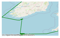
CE16012 INFOMAR (Seabed Mulitbeam) Survey
The INtegrated Mapping FOr the Sustainable Development of Ireland’s MArine Resource (INFOMAR) programme is a joint venture between the Geological Survey of Ireland (GSI) and the Marine Institute (MI). The programme is a successor to the Irish National Seabed Survey (INSS) and concentrates on creating a range of integrated mapping products of the physical, chemical and biological features of the seabed in the near-shore area. This cruise took place on board the R.V. Celtic Explorer in 2016 from 14th-22nd of September approximately 150 Km south of the Cork coast. In order to avail of the offshore seagoing capabilities of the R.V. Celtic Explorer, an area relatively far from the coast and very exposed to weather was deliberately selected. Surveys conducted include: Multibeam Echo Sounder (MBES) hydrographic survey to International Hydrographic Organisation (IHO) Order 1a standard. Bathymetry survey: to produce bathymetry shaded relief and backscatter mosaic products which provide depth, seabed features and seabed hardness information. Sub Bottom Profiler (SBP) survey: to acquire data of the shallow (up to 30 metres) sub seabed to determine the existence of buried objects and ascertain the sub-seabed character. Groundtruthing was performed with a vibrocorer. 10 vibrocore samples were collected. An area of 715km2 was covered during this survey. High resolution multibeam mapping of the seabed. High resolution shallow seismic data and magnetometer data. Testing SBP and MBES configurations for the 2017 season where we anticipate using the CE for a longer time period and vibrocoring operations to circa. 100 metres, using stern of the ship's position.
Simple
- Date (Publication)
- 2018-01-02
- Date (Revision)
- 2018-11-29
- Date (Creation)
- 2018-01-02
- Citation identifier
- ie.marine.data:dataset.1572
- Point of contact
-
Organisation name Individual name Electronic mail address Role Marine Institute
Originator
- Maintenance and update frequency
- As needed
- Use limitation
-
While every effort is made in preparing the dataset no responsibility is accepted by or on behalf of the Marine Institute for any errors, omissions or misleading information. The Marine Institute accepts no responsibility for loss or damage occasioned or claimed to have been occasioned, in part or in full, as a consequence of any person acting, or refraining from acting as a result of a matter contained in this datasets or as a consequence of using this dataset for any purpose whatsoever.
- Use limitation
-
A Creative Commons (CC) license is one of several public copyright licenses that enable the free distribution of an otherwise copyrighted work. A CC license is used when an author wants to give people the right to share, use, and build upon a work that they have created. Under Creative Commons CC BY 4.0 the following is granted: Rights Share — copy and redistribute the material in any medium or format; Adapt — remix, transform, and build upon the material for any purpose, even commercially. The licensor cannot revoke these freedoms as long as you follow the license terms. Requirements Attribution — You must give appropriate credit, provide a link to the license, and indicate if changes were made. You may do so in any reasonable manner, but not in any way that suggests the licensor endorses you or your use. No additional restrictions — You may not apply legal terms or technological measures that legally restrict others from doing anything the license permits.
- Access constraints
- CC%20BY%204.0
- Aggregate Datasetindentifier
- ie.marine.data:instrument.190
- Association Type
- Cross reference
- Initiative Type
- Sensor
- Aggregate Datasetindentifier
- ie.marine.data:instrument.813
- Association Type
- Cross reference
- Initiative Type
- Sensor
- Aggregate Datasetindentifier
- ie.marine.data:instrument.1428
- Association Type
- Cross reference
- Initiative Type
- Sensor
- Aggregate Datasetindentifier
- ie.marine.data:platform.33
- Association Type
- Cross reference
- Initiative Type
- Platform
- Aggregate Datasetindentifier
- ie.marine.data:dataset.858
- Association Type
- Cross reference
- Initiative Type
- Collection
- Aggregate Datasetindentifier
- ie.marine.data:dataset.860
- Association Type
- Cross reference
- Initiative Type
- Collection
- Aggregate Datasetindentifier
- ie.marine.data:dataset.867
- Association Type
- Cross reference
- Initiative Type
- Collection
- Aggregate Datasetindentifier
- ie.marine.data:dataset.845
- Association Type
- Cross reference
- Initiative Type
- Collection
- Spatial representation type
- Grid
- Language
- English
- Begin date
- 2016-09-14
- End date
- 2016-09-22
))
- Reference system identifier
- INSPIRE RS registry / http://www.opengis.net/def/crs/EPSG/0/3857
- Distribution format
-
Name Version CSV Underway Data
- OnLine resource
-
Protocol Linkage Name WWW:LINK-1.0-http--link
http://www.infomar.ie/
- OnLine resource
-
Protocol Linkage Name WWW:LINK-1.0-http--link
http://www.marine.ie
- OnLine resource
-
Protocol Linkage Name WWW:LINK-1.0-http--link
https://www.gsi.ie/
- Hierarchy level
- Dataset
Conformance result
- Title
-
Commission Regulation (EU) No 1089/2010 of 23 November 2010 implementing Directive 2007/2/EC of the European Parliament and of the Council as regards interoperability of spatial data sets and services
- Date (Publication)
- 2010-12-08
- Explanation
-
See the referenced specification
- Pass
- Yes
- Statement
-
Data supplied by Marine Institute.
Metadata
- File identifier
- ie.marine.data:dataset.1572 XML
- Metadata language
- English
- Hierarchy level
- Collection session
- Date stamp
- 2025-02-21T18:14:49.767723Z
- Metadata standard name
-
ISDI Metadata Profile
- Metadata standard version
-
1.2
- Metadata author
-
Organisation name Individual name Electronic mail address Role Marine Institute
Point of contact
)))
