 Irish Spatial Data Exchange
CE17008 Exploiting and Conserving Deep-Sea Genetic Resources: SFI cruise I
This 13 day survey, led by National University of Ireland, Galway (NUIG) took place on board the Marine Institute's R.V. Celtic Expolerer in May/June 2017 in the North East Atlantic. The survey was conducted to collect large Porifera and Cnidaria, groups with known biodiscovery potential, and some other taxa which have already shown bioactive potential in previous surveys carried out in NUIG. This survey was the first cruise of the Science Foundation Ireland (SFI)/Marine Institute co-funded project “Exploiting and Conserving Deep-sea Genetic Resources” which commenced in September 2016. The cruise thus makes a direct contribution to Ireland’s desire to increase capacity in Marine Biodiscovery and tap into the economic potential of the marine environment. The remotely operated vehicle (ROV) Holland 1 was deployed and ROV video and still image data was obtained, as well as specimens collected. Conductivity-temperature-depth (CTD) sampling was conducted, and multibeam surveys carried out. The survey objectives were to collect fauna – specifically sponges and corals - and high definition video data using the Irish deep-water ROV Holland I deployed from Celtic Explorer from a diversity of deep-water habitats. The wider objectives of the Science Foundation Ireland Investigators programme project Exploiting and conserving deep-sea genetic resources focuses on biodiscovery research in Irish deep-sea Cnidaria and Porifera. The aims are to: find new bioactive natural products from deep-sea corals and sponges in Irish offshore waters develop informed bioprospecting approaches to maximise the chance of finding these compounds in hard to sample environments such as the deep sea inform conservation planning in relation to biodiscovery hotspots
Simple
- Date (Publication)
- 2017-12-20
- Date (Revision)
- 2023-06-01
- Date (Creation)
- 2017-12-20
- Citation identifier
- ie.marine.data:dataset.1501
- Point of contact
-
Organisation name Individual name Electronic mail address Role Marine Institute
Originator
- Maintenance and update frequency
- As needed
- Use limitation
-
While every effort is made in preparing the dataset no responsibility is accepted by or on behalf of the Marine Institute for any errors, omissions or misleading information. The Marine Institute accepts no responsibility for loss or damage occasioned or claimed to have been occasioned, in part or in full, as a consequence of any person acting, or refraining from acting as a result of a matter contained in this datasets or as a consequence of using this dataset for any purpose whatsoever.
- Use limitation
-
A Creative Commons (CC) license is one of several public copyright licenses that enable the free distribution of an otherwise copyrighted work. A CC license is used when an author wants to give people the right to share, use, and build upon a work that they have created. Under Creative Commons CC BY 4.0 the following is granted: Rights Share — copy and redistribute the material in any medium or format; Adapt — remix, transform, and build upon the material for any purpose, even commercially. The licensor cannot revoke these freedoms as long as you follow the license terms. Requirements Attribution — You must give appropriate credit, provide a link to the license, and indicate if changes were made. You may do so in any reasonable manner, but not in any way that suggests the licensor endorses you or your use. No additional restrictions — You may not apply legal terms or technological measures that legally restrict others from doing anything the license permits.
- Access constraints
- CC%20BY%204.0
- Aggregate Datasetindentifier
- ie.marine.data:instrument.45
- Association Type
- Cross reference
- Initiative Type
- Sensor
- Aggregate Datasetindentifier
- ie.marine.data:instrument.195
- Association Type
- Cross reference
- Initiative Type
- Sensor
- Aggregate Datasetindentifier
- ie.marine.data:instrument.198
- Association Type
- Cross reference
- Initiative Type
- Sensor
- Aggregate Datasetindentifier
- ie.marine.data:instrument.199
- Association Type
- Cross reference
- Initiative Type
- Sensor
- Aggregate Datasetindentifier
- ie.marine.data:platform.33
- Association Type
- Cross reference
- Initiative Type
- Platform
- Aggregate Datasetindentifier
- ie.marine.data:dataset.845
- Association Type
- Cross reference
- Initiative Type
- Collection
- Aggregate Datasetindentifier
- ie.marine.data:dataset.4025
- Association Type
- Cross reference
- Initiative Type
- Collection
- Aggregate Datasetindentifier
- ie.marine.data:dataset.848
- Association Type
- Cross reference
- Initiative Type
- Collection
- Aggregate Datasetindentifier
- ie.marine.data:dataset.4014
- Association Type
- Cross reference
- Initiative Type
- Collection
- Spatial representation type
- Grid
- Language
- English
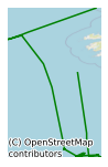
- Begin date
- 2017-05-23
- End date
- 2017-06-05
))
- Reference system identifier
- INSPIRE RS registry / http://www.opengis.net/def/crs/EPSG/0/3857
- Distribution format
-
Name Version ASCII Underway Data
CSV CTD Data
CSV Underway Data
CSV pCO2 Data
HTML Underway Data
JSON Underway Data
KML Underway Data
NetCDF Underway Data
- OnLine resource
- OnLine resource
- OnLine resource
- OnLine resource
- OnLine resource
- OnLine resource
-
Protocol Linkage Name WWW:LINK-1.0-http--link
http://www.marine.ie
- OnLine resource
-
Protocol Linkage Name WWW:LINK-1.0-http--link
https://www.sfi.ie/funding/funding-calls/sfi-investigators-programme/
- OnLine resource
- Hierarchy level
- Dataset
Conformance result
- Title
-
Commission Regulation (EU) No 1089/2010 of 23 November 2010 implementing Directive 2007/2/EC of the European Parliament and of the Council as regards interoperability of spatial data sets and services
- Date (Publication)
- 2010-12-08
- Explanation
-
See the referenced specification
- Pass
- Yes
- Statement
-
Data supplied by Marine Institute.
Metadata
- File identifier
- ie.marine.data:dataset.1501 XML
- Metadata language
- English
- Hierarchy level
- Collection session
- Date stamp
- 2025-02-21T18:13:06.799782Z
- Metadata standard name
-
ISDI Metadata Profile
- Metadata standard version
-
1.2
- Metadata author
-
Organisation name Individual name Electronic mail address Role Marine Institute
Point of contact
)))
