 Irish Spatial Data Exchange
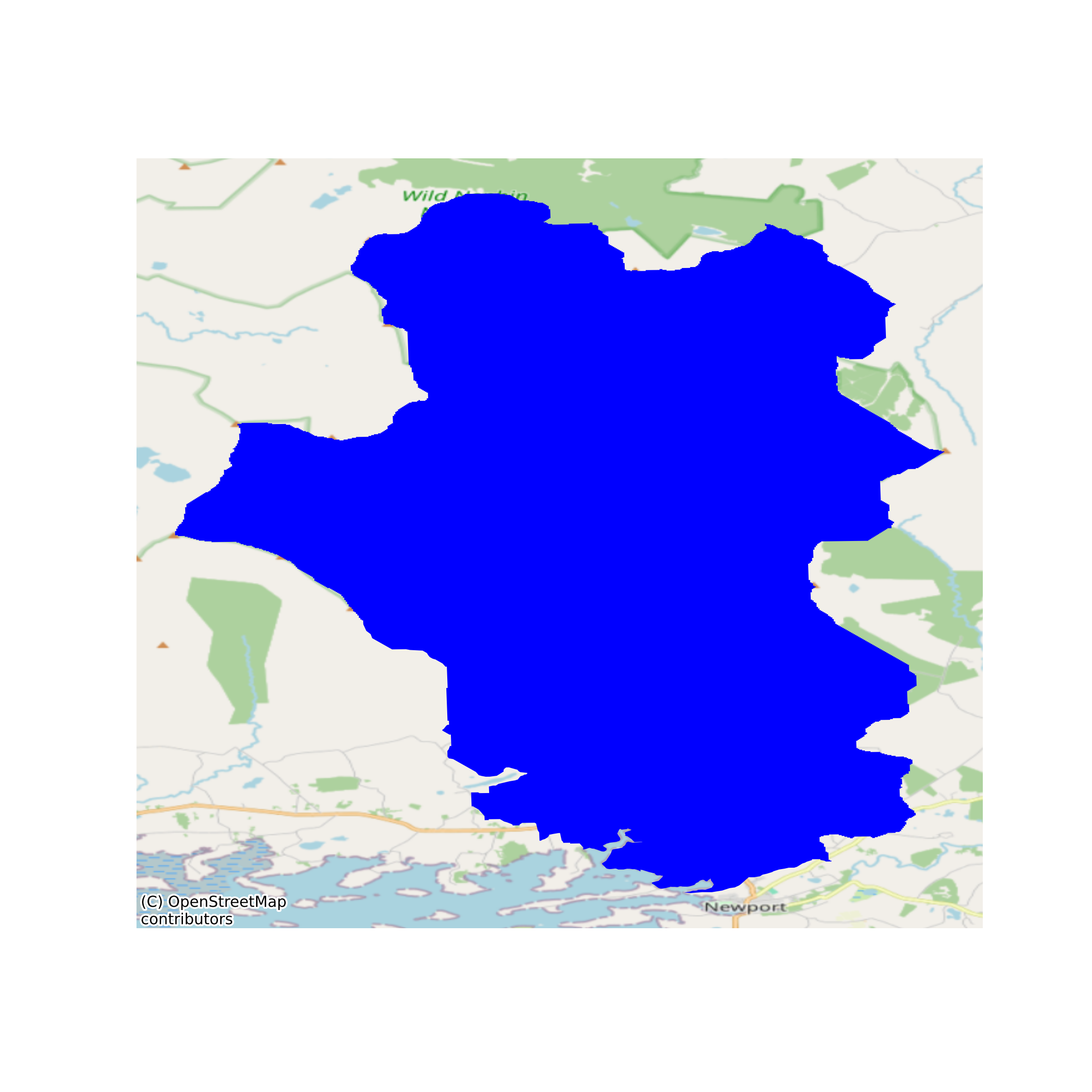
Bathymetric Survey of Lough Feeagh, Co. Mayo.
Bathymetry water depth survey using echosounder on Lough Feeagh in the Burrishoole catchment on Co. Mayo, Ireland. Data includes Esri Grid and contour vector lines at 1m intervals. None
Simple
- Date (Publication)
- 2017-12-05
- Date (Revision)
- 2018-11-29
- Date (Creation)
- 2017-12-05
- Citation identifier
- ie.marine.data:dataset.1226
- Point of contact
-
Organisation name Individual name Electronic mail address Role Marine Institute
Originator
- Maintenance and update frequency
- As needed
- Use limitation
-
While every effort is made in preparing the dataset no responsibility is accepted by or on behalf of the Marine Institute for any errors, omissions or misleading information. The Marine Institute accepts no responsibility for loss or damage occasioned or claimed to have been occasioned, in part or in full, as a consequence of any person acting, or refraining from acting as a result of a matter contained in this datasets or as a consequence of using this dataset for any purpose whatsoever.
- Use limitation
-
Standard License Agreement for use of Marine Institute Digital Data that has been requested through the Marine Institute Data Request Service and is not available as open access via a Marine Institute data service.
- Access constraints
- Marine%20Institute%20License
- Spatial representation type
- Vector
- Language
- English
- Begin date
- 2003-01-01
- End date
- ..
))
- Reference system identifier
- INSPIRE RS registry / http://www.opengis.net/def/crs/EPSG/0/3857
- OnLine resource
-
Protocol Linkage Name WWW:LINK-1.0-http--link
http://www.marine.ie
- Hierarchy level
- Dataset
Conformance result
- Title
-
Commission Regulation (EU) No 1089/2010 of 23 November 2010 implementing Directive 2007/2/EC of the European Parliament and of the Council as regards interoperability of spatial data sets and services
- Date (Publication)
- 2010-12-08
- Explanation
-
See the referenced specification
- Pass
- Yes
- Statement
-
Data supplied by Marine Institute.
Metadata
- File identifier
- ie.marine.data:dataset.1226 XML
- Metadata language
- English
- Hierarchy level
- Dataset
- Date stamp
- 2018-11-29
- Metadata standard name
-
ISDI Metadata Profile
- Metadata standard version
-
1.2
- Metadata author
-
Organisation name Individual name Electronic mail address Role Marine Institute
Point of contact
)))
